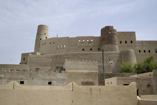
Bahla Fort

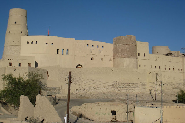
Bahla Fort is one of four historic fortresses situated at the foot of the Djebel Akhdar highlands in Oman. It was built in the 13th and 14th centuries, when the oasis of Bahla was prosperous under the control of the Banu Nebhan tribe. The forts ruined adobe walls and towers rise some 165 feet above its sandstone foundations. Nearby to the southwest is the Friday Mosque with a 14th-century sculpted mihrab. The fort was not restored or conserved before 1987, and had fallen into a parlous state, with parts of the walls collapsing each year in the rainy season.
image
Bahla Fort

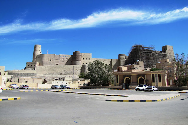
The fort became a UNESCO World Heritage Site in 1987. It was included in the List of World Heritage Sites in danger from 1988. Restoration works began in the 1990s, and nearly $9m were spent by the Omani government from 1993 to 1999. It remained covered with scaffolding and closed to tourists for many years. It was removed from the list of endangered sites in 2004.

The Fort at Bahla, together with the nearby forts at Izki and Nizwa, and one further north at Rustaq, were centres of Kharajite resistance to the "normalization" of Caliph Harun al-Rashid. The town of Bahla, including the oasis, suq and palm grove, is itself surrounded by adobe walls some 12 km long. The town is well known for its pottery.
image

image

image

image

image

image

image

image

image

Comments

Popular posts from this blog

Nabatean City of Petra

Petra is a historical and archaeological city in the Jordanian governorate of Ma'an that is famous for its rock cut architecture and water conduits system. Established sometime around the 6th century BC as the capital city of the Nabataeans, it is a symbol of Jordan as well as its most visited tourist attraction. It lies on the slope of Mount Hor in a basin among the mountains which form the eastern flank of Arabah (Wadi Araba), the large valley running from the Dead Sea to the Gulf of Aqaba. Petra has been a UNESCO World Heritage Site since 1985. Petra

Karstic Peaks Guilin

Yangshuo is located in Yangshuo Town. Surrounded by karst peaks and bordered on one side by the Li River. It is easily accessible by bus or by boat from nearby Guilin. Over the years, it has become popular with foreign backpackers. Visitors to Yangshuo can swim in the Li River or the cleaner Yu Long (Dragon River), climb one of many nearby karst peaks, hire a bicycle for a cycling trip through the karst scenery, arrange a sightseeing trip on the Li River by bamboo raft or cruise boat, or visit a number of local cave systems, including a butterfly cave. Karstic Peaks Guilin

Garajonay National Park

Laurel forest covers some 70% of this park, situated in the middle of the island of La Gomera in the Canary Islands archipelago. The presence of springs and numerous streams assures lush vegetation resembling that of the Tertiary, which, due to climatic changes, has largely disappeared from southern Europe. La Gomera lies to the west of Tenerife, and is one of seven islands that make up the Canary Islands archipelago off the north-west coast of Africa in the Atlantic. The island is accessible by ferry from Tenerife. The park can be reached by road from the island's major towns and villages. Garajonay National Park