Rock Sites of Cappadocia
Peble Jeine
In a spectacular landscape, entirely sculpted by erosion, the Göreme valley and its surroundings contain rock-hewn sanctuaries that provide unique evidence of Byzantine art in the post-Iconoclastic period. Dwellings, troglodyte villages and underground towns – the remains of a traditional human habitat dating back to the 4th century – can also be seen there.
 |
| Göreme National Park and the Rock Sites of Cappadocia |
The rupestral sanctuaries of Cappadocia constitute an unique artistic achievement in a region of superlative natural features, providing irreplaceable testimony to post-iconoclast Byzantium. The dwellings, village convents and churches retain the fossilized images of a province of the Byzantine Empire between the 4th century and the Turkish invasion.
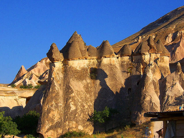
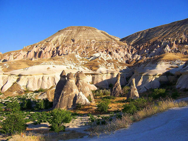
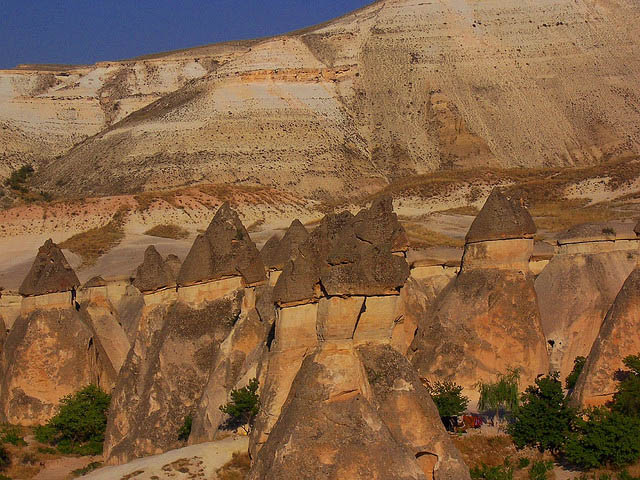
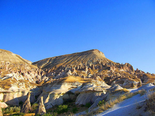
The eroded plateau of the Göreme valley is a spectacular example of the effects of differential erosion of the volcanic tuff sediments by wind and water. Typical features are pillars, columns, towers, obelisks and needles that reach heights of 40 m. The major remnant of erosion, Akdağ (1,325 m), is the dominant feature in the valley. The nearby Erciyas volcano is still active with occasional minor eruptions. Its outstanding example represents the Earth's evolutionary history. Within these rock formations people have excavated a network of caves which served as refuges, residences, storage and places of worship dating from the 4th century. The surrounding landscape is agricultural with a number of small scattered rural villages.
The historical setting, the rock-hewn churches and the unusual eroded landforms combine to produce a mixed cultural/natural landscape of unusual appearance. Architectural styles are based on the local stone and the valley has changed little over the centuries.
Although the area has been extensively used and modified by man for centuries the resulting landscape is one of harmony and consideration of the intrinsic values of the natural landforms. There has been some earthquake damage to some of the cones and pillars but this is seen as a naturally occurring phenomenon. In the ruin like landscape of the Cappadocia plateau where natural erosion has sculpted the tuff into shapes which are eerily reminiscent of towers, spires, domes and pyramids, man has added to the workmanship of the elements by digging cells, churches and veritable subterranean cities which together make up one of the world's largest cave dwelling complexes. Although interesting from a geological and ethnological point of view, this phenomenal rupestral site excels especially for the incomparable beauty of the decor of the Christian sanctuaries whose features make Cappadocia one of the leading examples of post-iconoclast Byzantine art.
It is believed that the first signs of monastic activity in Cappadocia date back to the 4th century at which time, acting on the instructions of Basil the Great, Bishop of Caesarea (Kayseri), small anchoritic communities began inhabiting cells dug into the rock. Later on, in order to resist Arab forays they began banding together into troglodyte villages or subterranean towns such as Kaymaklı or Derinkuyu which served as places of refuge.
Cappadocian monasticism was already well established in the iconoclast period (725-842), as illustrated by the many sanctuaries, the decoration of which was held to the strict minimum of symbols (most often sculpted or tempera painted crosses). After 842, however, many rupestral churches were dug in Cappadocia. These churches were richly decorated with brightly coloured figurative painting. Among them were those in the Göreme valley: Tokalı Kilise, El Nazar Kilise (10th century), Barbara Kilise, Saklı Kilise (11th century), Elmalı Kilise and Karanlık Kilise (end of the 12th to beginning of the 13th centuries), etc.


Enter your first comment!